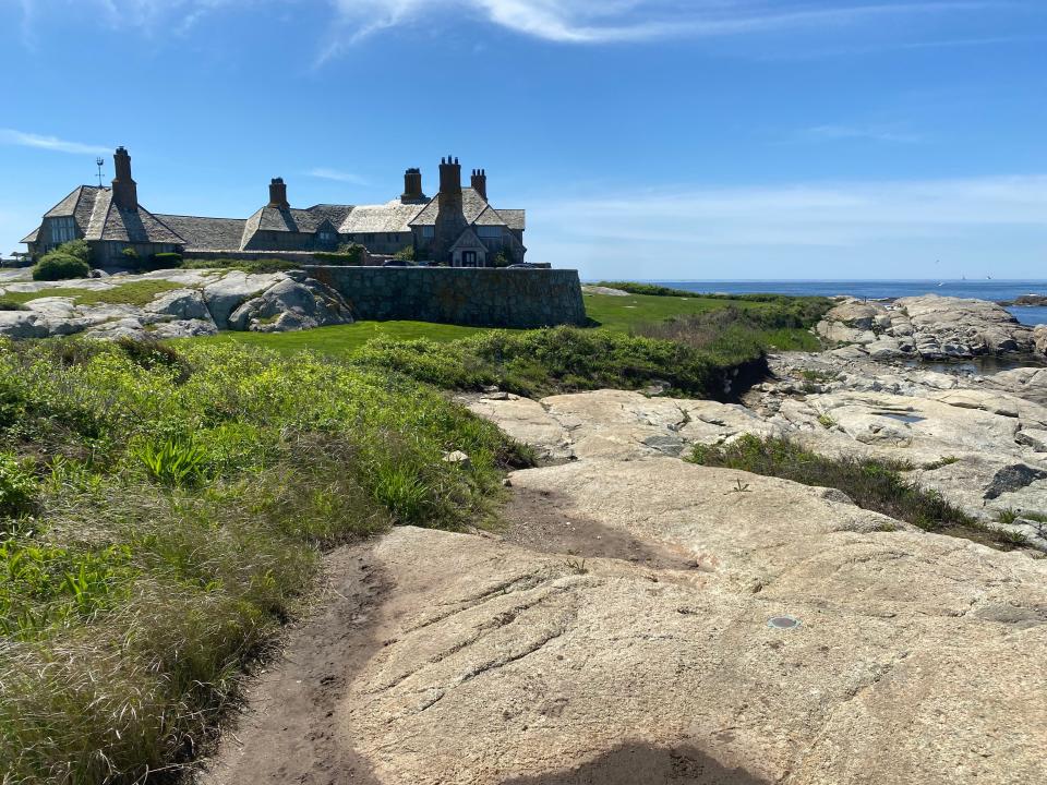
What forced rich New Yorkers to let everyday people walk on the cliffs in Newport?
NEWPORT – Although Henry T. Tuckerman enjoyed his daily walks along the cliffs in the southeast part of town, he could never get out of his mind the potential for disaster.
His premonitions proved true one September day in 1849. The noted essayist and summer Newport resident recounted the events in a letter published on Oct. 11 that year in the Herald of the Times, a Newport newspaper of the day.
Of course, the harrowing incident in Tuckerman's account involved a boy trying to impress a girl.

The young man in question and his betrothed, along with some friends, had hiked to the bottom of the location now known as the Forty Steps, site of what was then known as Conrad's Cave. The young man sought to show off his prowess by climbing the face of the rocky cliff. He got most of the way to the top before he found himself with no way to continue higher, no courage to climb down and his perch above jagged rocks ever more tenuous.
At the suggestion of a young woman in the group, several men unharnessed a horse that was tethered to a wagon in a nearby field. They used the rigging to haul the victim up to the top, leaving nothing more injured than his ego.
Does the Cliff Walk trace its origin to a particular event?
Tuckerman is far from the last summer visitor to enjoy a walk along Newport's cliffs, and he undoubtedly was not the first.
Local tradition holds that wild deer made paths along the top of the cliffs, blazing routes for the island's Indigenous tribes long before European settlers would follow in their footsteps.
More: The Cliff Walk continues to crumble into the sea. Are repairs worth Newport's investment?
While the early origins of what became known as the "Cliff Walk" were never recorded, history sheds light on what is perhaps a bigger mystery:
Why did the wealthy New Yorkers who built mansions along the Newport coast during the Gilded Age let the general public traipse across their well-manicured lawns?
It's not because the Rhode Island Constitution of 1842 enshrined rights to shore access.

Nor is it because the Royal Charter of 1663 granted the rights of the fishery to the public.
No, the public's right to walk across the top of the cliffs stretches further back, according to a clue left behind in the land deeds stored in City Hall.
What clue is held in a land deed?
In the mid-1800s, Daniel Parish owned large swaths of farmland in the area where Vanderbilts, Astors and Goelets would one day build their mansions.
On Aug. 28, 1852, Parish sold a chunk of land to Aquila G. Stout, a wealthy New York merchant, banker and insurance company executive. After Stout's death, his heirs sold the property to Alva E. Vanderbilt, a leading socialite and suffragette, the real-life inspiration for the fictional character Bertha Russell in "The Gilded Age" TV series. Vanderbilt, after a second marriage to Oliver Hazard Perry Belmont, would live in the Marble House mansion on the site.
While Vanderbilt would arrive later, the clue behind public access is from the 1852 deed between Parish and Stout, though they made no mention of public rights along the cliffs. Instead, someone – it's not clear who – added a note, written sideways in the margin, drawing attention to an ancient vote by the General Assembly of Rhode Island.
On March 6, 1639, according to the note, the Assembly met, at a time when the Colony of Providence Plantations was still separate from the Colony of Rhode Island, which included only Newport and Portsmouth. (Other sources place the meeting on the same day in 1640, still two decades before the Royal Charter.)

According to early Colonial records of that March 6 meeting, archived by the secretary of state, the General Assembly ordered that, in the town of Newport, the "sea banks" were free, open to everyone, from the top of the cliffs down to the water.
How did the Cliff Walk evolve?
"Thanks to the foresight of our forefathers, the cliff walk is ours," the Newport Mercury observed on New Year's Day in 1887.
"No owner of land bordering on the sea can refuse this inalienable privilege," the Providence Daily Journal reported on Aug. 19, 1871, when the paper offered an explanation of why the Cliff Walk is fancier than just a dirt path trampled by deer: "The owners of real estate lying on the cliffs vie with each other in making their grounds attractive, carefully laying out traveled paths, building sea-walls, and covering every unsightly object with a close-cut greensward."
While that may have been the attitude in the 1870s, later in the 19th century some wealthy landowners displayed hostility toward the public crossing their land and snooping in their backyards.

In strategies that still mark the landscape in the 21st century, owners erected hedges and fences to screen their land and located the pathway at lower elevations so the side of the hill blocked the view of their houses. William K. Vanderbilt, first husband of Alva Vanderbilt, even went so far as to run the Cliff Walk through a tunnel behind Marble House.
"The cliff walk runs under the lawn in a tunnel, so that an unobstructed lawn is obtained to the water’s edge," the Providence News reported on May 9, 1892. "This arrangement is not likely to be popular if it is often adopted."
(In 2024, there are two tunnels and one bridge along the route of the Cliff Walk, plus an arch over a closed section of the path.)
This article originally appeared on The Providence Journal: History of Newport's Cliff Walk goes back a long way, a very long way
