Is this Britain's most beautiful coastal walk?

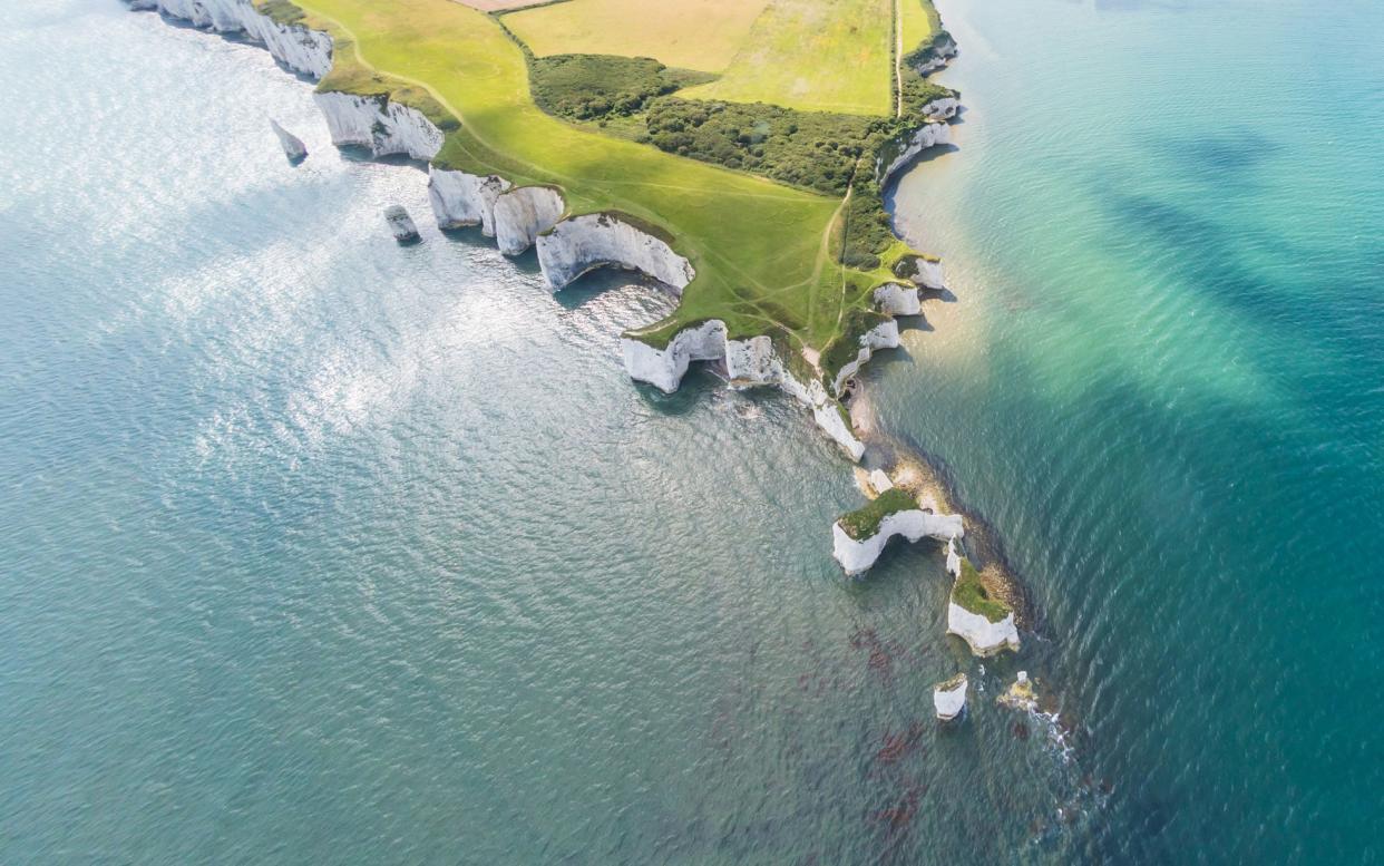
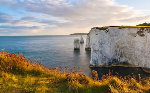
This walk alongside white chalk stacks, believed to be named after a notorious local pirate, Harry Paye, is one of the best ways to take in the Jurassic Coast. Alongside the magnificent geological formations, those who visit in spring and summer can expect to see scarlet pimpernels, poppies, sheep's bit and harebells, alongside distinctive pink pyramidal orchids. Chalkhill Blue butterflies can also often be found feeding from yellow kidney vetch flowers, while it is not uncommon to see peregrine falcons hunting for food for their young.
According to Paul Bradley, East Purbeck Lead Ranger, the best part of this walk is the climb up to Ballard Down: "A well-placed stone seat inscribed 'Rest and be Thankful' provides an opportunity to sit down and take in the far-reaching views".
Such panoramas make it easy to see why the area has been used as an important vantage point since the early pre-historic times. "A stone axe from the Palaeolithic era, Bronze-age burial barrows and Celtic field systems are just a few of the archaeological finds that have been found in the area and in more recent history, the Down was used as a firing range for trainee fighter pilots during the Second World War II", says Bradley. "These days, however, it happens to be a great spot for a picnic."
Aemelia Roe, an East Purbeck ranger, said she once met a member of the public on the route who was from the Midlands and had never seen the UK coast before: "He simply said –'Wow! I never knew we had views like this in Britain!"
"This is a place of reflection and building memories", says Roe. "Many people revisit over and over often with friends and relatives. I don’t think I will ever tire of the views from this stretch of coastline.”

Grade: Easy
Distance: 3.5 miles (5.5km)
Time: 1 hour to 2 hours
OS Map: Explorer OL15; Landranger 195
Terrain: This is a fairly gentle walk, normally with good conditions underfoot. There is one steady climb up Ballard Down. Beware of sheer cliff edges on and approaching Old Harry. Dogs are welcome under close control.
How to get here
By foot: From the crossroads in Studland village, take the lane by post office and follow it to Bankes Arms pub
By bike: Leave the National Cycle Network Route 2 where it joins the Ferry Road, then head south into Studland for 1 mile (1.6km), and follow foot directions
By car: Follow B3351 from Corfe Castle for 5 miles (8km), or drive from Poole to Studland via the chain ferry. The South Beach car park can be found at BH19 3AU
The route
Start: South Beach car park, grid ref: SZ038824
1. From the car park walk down the road past the Bankes Arms pub and turn left by the public toilets on to the path signed for Old Harry. Look out for rectangular earthworks in the wood near Old Harry which are the remains of fields used by Celtic farmers.
2. From Old Harry follow the coast path up a gentle rise, keeping well back from the sheer cliff edge.
Point of interest: Old Harry, and the remains of Old Harry's wife, have been carved by the pounding waves. Together they form one of Dorset's most famous landmarks. Savour the fine views across Poole Bay to Bournemouth, Hengistbury Head and the Isle of Wight.
3. At the first gate, keep to the cliff top path. During spring there's a good variety of chalk grassland flowers in the short turf. Look back to enjoy a fine view of the Pinnacle stack.
Point of interest: Look out for peregrine falcons circling high above. This stocky falcon can fold back its wings and stoop on its prey with incredible speed. Listen out for its wild, piercing cry.
4. Go through a farm gate, passing earthworks, and head along Ballard Down.
Point of interest: With its bulky body and massive bill, the greater black-backed gull is our largest gull species. Look for them roosting on the stacks or flying on up-draughts of wind along the cliff tops.
5. Just before the stone bench marked 'Rest and be thankful', where the main paths cross, turn right down the hill towards Studland.
6. Follow the road down through the Glebeland estate.
7. Go straight on at the crossroads, following the sign for the church. On your right is the village cross, which was erected in 1976. The carvings depict a range of images both ancient and modern.

8. At the end of the lane, go through the gate into the churchyard. Pass the church on your right then turn immediately right and follow the footpath back to your starting point.
End: South Beach car park, grid ref: SZ038824
